
I discovered a new term that relates to the surveying and layout of Texas when USGS Markers were place primarily along roadways and railroads from points all over the state.
I knew the markers were placed, but had never thought about the timeframe in which it was undertaken.
This name Spirit Leveling comes from the use of a spirit level used in surveying equipment.
Below is a report as is relates to this being done all over Texas from 1896 to 1915.

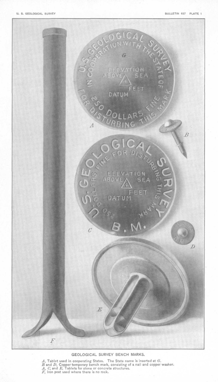
When I worked for the Travis County Engineering Department as a member of the only survey crew, one of our tasks was to locate many of the these USGS Markers/Bench Marks [elevation markers] and then set and tie-in to Travis County’s disks. The survey supervisor had came by a dislocated USGS Marker Disc and had similar discs created with the Travis County Information stamped into the top of the disc. We conducted numerous level loops to tie these discs with a proven elevation.
We would often dig holes 2-3 feet in depth and mix and pour cement and the place the disc before the cement hardened. These were often around established in roadway and the depth was to hopefully protect the disc in the event of future road construction work…
I’ve oftened wondered what future surveyors will think and experience when they in turn look for and expose the discs we had set. Many will probably not be discovered for many years after we Travis County surveyors are gone.
Surveyors [at least I was] are often told stories of reading old field notes from the 1800’s and it was termed ‘following in their footsteps…
LikeLiked by 1 person
Interesting
LikeLike